
Rethinking the First Mile in Suburban Communities
A regional rail line can pass within a few miles of thousands of homes and still feel unreachable. In many suburban communities, the station exists, trains run on a dependable schedule, and parking fills quickly, yet the route from a front door to the platform is unsafe, inconvenient, or simply too long to walk. This is the suburban transit paradox: substantial investment in regional service is undermined by a missing first connection. The problem is not the absence of transit, but the gap between local streets and the larger network.
That gap does not make transit integration impossible. It calls for a more deliberate design response. A useful starting point is to treat the first mile as a complete mobility system, not as an afterthought. First and last mile planning recognizes that riders need dependable connections between stations and homes, workplaces, schools, shopping areas, and other daily destinations. With on-demand neighborhood services, protected active mobility corridors, and secure station gateways working together, dispersed neighborhoods can become connected transit catchments rather than isolated pockets of car dependence.
On-Demand Microtransit as a Flexible Neighborhood Bridge
Fixed-route buses are often the wrong tool for low-density suburban streets. A conventional route must cover a broad area even when demand is concentrated around a handful of morning and evening travel periods. The result can be long distances between stops, infrequent service, and vehicles operating with few passengers outside peak times. For transit agencies, maintaining coverage is expensive. For residents, the service can feel too slow or uncertain to replace a private car.
On-demand microtransit offers a more adaptable connection. Riders request a trip through an app, website, telephone line, or sometimes a staffed booking channel. Scheduling software groups compatible trips, adjusts routing in response to demand, and directs a smaller shuttle to designated pickup points or virtual stops. The service can collect riders from neighborhood corners, apartment complexes, senior housing, or commercial centers and deliver them to a rail station or frequent bus corridor. It is not a private taxi; its value comes from sharing rides and organizing demand around common destinations.
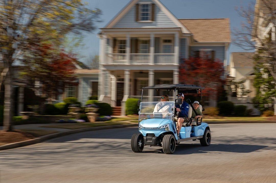
The strongest programs are designed as complements to the public network. Guidance from the European Commission urban mobility group emphasizes coordination, affordability, inclusion, dependable performance, and integration with broader transport policy. That means microtransit should not simply duplicate a productive bus route or withdraw service from residents who cannot use a smartphone. It should fill identifiable gaps, connect with scheduled departures, and provide clear standards for wait times, accessibility, fares, and service hours.
- Use neighborhood pickup points where door-to-door routing would create excessive delay.
- Coordinate vehicle arrivals with rail and express bus schedules rather than treating each trip as an isolated booking.
- Offer telephone and accessible booking options alongside digital tools.
- Track wait times, missed connections, wheelchair access, passenger loads, and repeat use.
- Set performance targets that distinguish genuine network improvement from simple trip substitution.
Predictability is central to ridership. A commuter may tolerate a five-minute walk to a virtual stop if the shuttle arrives within a defined window and connects reliably with the train. Conversely, even a free service will struggle if bookings are rejected, pickup times shift without warning, or the transfer requires a long wait. Agencies should therefore measure ridership rebounds through before-and-after surveys, station access counts, vehicle occupancy, and the share of riders who previously drove alone. The most valuable result is not merely more shuttle trips. It is a larger number of households that can confidently choose regional transit for regular travel.
Protected Active Mobility Corridors that Feed Regional Stations
For many suburban residents, cycling is not rejected because of distance alone. It is rejected because the route feels exposed. Painted shoulders, narrow lanes beside fast traffic, abrupt gaps at intersections, and poorly maintained surfaces make a short trip to the station feel unsuitable for children, older adults, inexperienced riders, and people using cargo bikes or e-bikes. A serious first-mile strategy must move beyond markings and create a connected, forgiving network.
Protected corridors use physical separation, intersection treatments, clear priority, and continuity to make active travel more comfortable. A useful example comes from Montgomery County, Maryland, where approximately one-half mile of separated bicycle lanes on Nebel Street was built to support a continuous connection toward the White Flint Metrorail Station. The project used six-foot-wide one-way lanes beside the curbs, flexposts, striped buffers, curb ramps, pedestrian refuge islands, signal changes, and a two-stage turn queue box. The lesson is broader than the length of the segment: station access improves when roadway design addresses the entire journey, including the difficult turns and crossings that often determine whether people ride.
County-level planning can also help prevent isolated projects. A corridor that ends at a municipal boundary or disappears before a multilane intersection does little to build confidence. Regional partners should map station catchments, identify missing links, and prioritize routes that connect residential streets to station entrances, schools, town centers, and employment areas. Planning claims should be evaluated through adopted plans, public project records, and completed infrastructure, since proposals and funding announcements do not always produce the same result on the ground.
- Identify the safest and most direct station approaches, then document every gap, crossing, steep grade, and conflict point.
- Build physical separation on roads with meaningful traffic speeds or volumes, using curbs, protected islands, planters, or other durable treatments where appropriate.
- Upgrade intersections with protected signal phases, daylighted sightlines, two-stage turn boxes, refuge islands, and accessible curb ramps.
- Provide continuous wayfinding, lighting, winter maintenance, drainage, and pavement quality from the local street network to the station entrance.
- Test designs with residents who are not regular cyclists, including older adults, families, people with disabilities, and e-bike users.
Comfort should be treated as a transportation performance measure. A corridor may be technically legal yet practically unusable for a large portion of the population. Protected infrastructure expands the potential rider base by reducing perceived risk and making travel times more consistent. It also strengthens the case for transit-oriented development because homes and businesses gain access to a station without requiring additional parking capacity for every trip.
Comparing Suburban First-Mile Solutions by Impact and Investment
No single intervention can serve every suburban setting. Microtransit is operationally flexible but requires continuing funding, dispatch technology, vehicles, drivers, and customer support. Protected paths require substantial design and construction investment, yet once built they can move people at low operating cost and remain available throughout the day. Shared micromobility can provide a quick, visible connection, but its success depends on vehicle availability, safe routes, charging arrangements, parking discipline, and a service area dense enough to support regular use.
| Solution | Capital profile | Operational flexibility | Rider capacity | Best suburban role |
|---|---|---|---|---|
| On-demand microtransit | Moderate vehicles and technology costs | High, routes can respond to demand | Low to moderate per vehicle | Serving dispersed neighborhoods and low-density gaps |
| Protected bicycle paths | Moderate to high construction costs | High once built | Moderate, with strong peak potential | Connecting nearby homes, schools, and town centers to stations |
| Shared bikes and scooters | Moderate fleet and station costs | High, if vehicles are well distributed | Low per vehicle, broad cumulative reach | Short station connections and flexible local circulation |
The right mix depends on street density and station proximity. A compact neighborhood within two miles of a station may benefit most from a protected bicycle grid, abundant bike parking, and a small shared-bike fleet. A spread-out subdivision with winding roads and limited sidewalks may need microtransit first, followed by targeted pedestrian and cycling improvements. Around major stations, agencies can combine all three: shuttles for distant neighborhoods, protected paths for nearby residents, and shared vehicles for the final connection from a commercial district or workplace.
Implementation should be staged rather than delayed by the search for a perfect network. Begin with a clear access audit, establish measurable goals, and test a limited service area or demonstration corridor. The Pittsburgh Regional Transit first and last mile framework illustrates the value of defining objectives and criteria for identifying access needs and future improvements. The same discipline helps communities direct scarce funds toward locations where a modest intervention can unlock substantial transit use.
Designing Station Gateways with Secure Micromobility Storage
A station can be close enough to reach by bicycle and still fail to attract riders if there is nowhere safe to leave the vehicle. Unsecured racks expose commuters to theft, weather, and damage. E-bike owners face an additional concern because their vehicles are more valuable and heavier than traditional bicycles. Scooters create similar problems when riders have no designated parking, charging, or storage area. Without a trustworthy endpoint, the active trip remains a gamble.
Modern station gateways should treat storage as essential infrastructure. Secure facilities can include controlled access, lighting, cameras, weather protection, repair tools, charging lockers, and space for different bicycle sizes. Fare integration can reduce friction further. A transit account, contactless payment card, or mobility application should ideally support the rail journey and the approved storage or shared-mobility service without requiring multiple registrations. The European mobility recommendations also point to the importance of mobility hubs, dedicated parking, charging, bicycle facilities, and service integration, while warning that shared services should complement rather than replace public transport.
- Locate secure storage along the natural path between the street and platform, not in an isolated corner of the parking lot.
- Provide spaces for standard bicycles, e-bikes, cargo bikes, adaptive cycles, and scooters.
- Offer transparent access rules, pricing, hours, maintenance responsibilities, and reporting procedures.
- Integrate storage information into journey-planning tools so riders can see availability before leaving home.
- Design agreements that protect affordability and access for residents without premium mobility subscriptions.
Collaborative delivery can make these facilities more achievable. A transit agency may provide station land and fare integration, a township may fund sidewalks, lighting, or streetscape improvements, and a private operator may manage lockers or shared vehicles under performance-based terms. Contracts should protect public goals by specifying availability, response times, data sharing, accessibility, and equitable service coverage. The station then becomes more than a rail platform. It becomes a dependable gateway where several modes meet without forcing the rider to solve every transfer independently.
Building the Blueprint for Connected Suburban Living
The first-mile dilemma is best solved as a coordinated program. On-demand microtransit provides coverage where homes are scattered. Protected active mobility corridors make short trips safe and comfortable. Secure storage and integrated fare systems give riders confidence that the journey will work from departure to platform. Together, these measures turn regional rail from a distant line into a practical daily option.
Planning leaders can create momentum by moving from broad ambition to a short sequence of accountable actions:
- Map station access conditions by neighborhood, including walking, cycling, shuttle, and micromobility options.
- Choose one or two high-value corridors for protected infrastructure and one clearly defined microtransit service area.
- Set targets for connection time, reliability, accessibility, ridership, safety, and reduced solo driving.
- Establish a cross-jurisdictional team involving transit agencies, municipalities, schools, employers, residents, and mobility operators.
- Publish results, adjust service and design, and expand the measures that produce durable changes in travel behavior.
The long-term payoff reaches beyond station access. Better first-mile connections can reduce pressure for ever-larger parking lots, support local businesses, improve household transportation choices, and make suburban growth more resilient. They also create a fairer network for people who cannot drive, should not drive, or prefer not to drive every day. Sprawl may shape the challenge, but it does not dictate the outcome. With steady investment and practical coordination, suburban communities can rebuild the connection between local life and regional mobility.

